Georeferenced maps to GIS layers
Do you have maps in image formats (jpeg, png, tiff, …) that you want as GIS layers?
Color Scan has an easy-to-use set of tools that will quickly convert your map images into GIS features that can be easily integrated, formatted and analyzed. All from a single toolbar within ArcGIS. Get a 30-day free trial today.
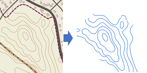
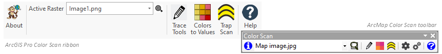
Trace Tools
Save time digitizing. No complex setup, just click on a line or polygon to capture.
Color Scan will:
- Trace lines and polygons with a single-click
- Attribute lines and polygons by color (ArcMap only)
- Save as vector features to a feature class or as a shapefile
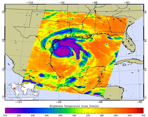
Hurricane Harvey. Credit: NASA/JPL-Caltech
Colors to Values
Convert an image with a color scale map into a raster grid of values. Get a clean raster grid free of other features, like text, graticules or geographic features that can then be contoured, symbolized or used with map algebra. Ideal for creating raster grids from maps that represent a measurement, such as:
- Depth/Elevation
- Temperature
- Speed
- Quantity
Color Scan will:
- Interpret colors and allocate values
- Create a raster grid of values
- Save to a geodatabase or as a GeoTiff
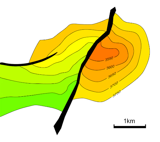
Trap Scan
Calculate area and volume from a depth/elevation image. Ideal for analyzing prospect maps. The image can be either a color filled or a black and white contoured map.
Color Scan will:
- Scale the map image without the need to georeference
- Calculate the area within a contour
- Calculate the cumulative volume of the surface
- Export the depth and area values to Microsoft Excel
- Export the contours as polygons to a feature class or a shapefile