Features of Color Scan
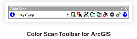
Color Scan has a set of tools to perform interpretation operations on georeferenced raster images in ArcMap. Use the tools to click and trace image features or select an area to set values for a color scale map.
Color Scan can:
Create features from georeferenced maps:
- Convert lines and polygons to vector features
- Create a raster grid from a color scale map
- Calculate depth/area and volume for a depth/elevation map
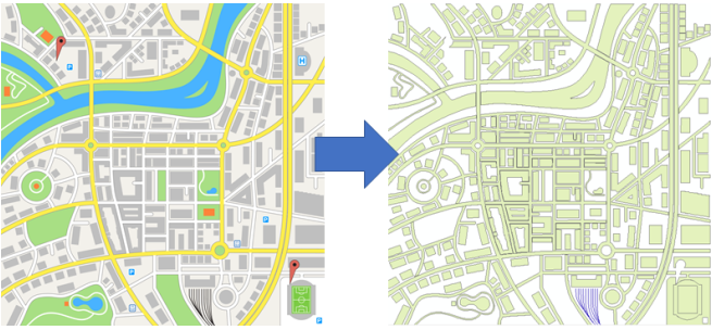
Vectorization
The process of vectorization converts pixels to vector features (points, lines and polygons). Vector features are saved as feature classes in a geodatabase or as shapefiles. There are many advantages to holding geographic features in a vector format. These include:
- Integrate with other map features
- Change the symbols of the features
- Perform analysis (for example, calculate area/length)
- Label features
- Import into other software packages (many software packages can load shapefiles)
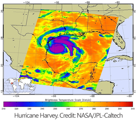
Color Grids
Many images have color maps to represent some kind of measurement. The following are examples of the type measurement often displayed:
- Depth/height
- Temperature
- Speed
- Quantity
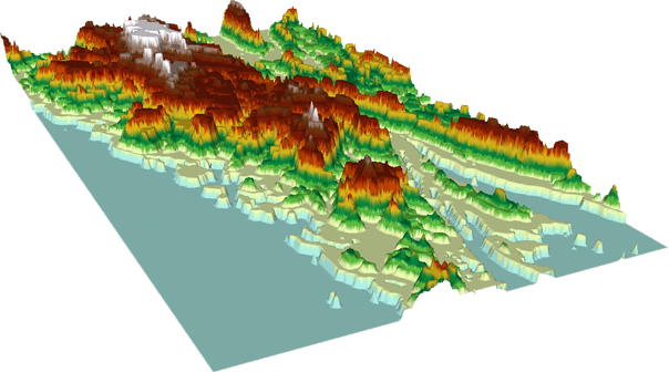
As an image the measurement information in each pixel is as a color code (red, green and blue value). However, a color grid can have the actual measurements embedded in each pixel. If you have archived and scanned color maps that could be more usefully utilized as color grids then Color Scan can convert the colors into values. As a color grid of values some of the operations that can be performed include:
- Modify color scheme
- Display in 3D (depth/height)
- Apply contours
- Carry out map algebra
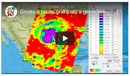
Video
Watch this video to see how to use the Colors to Values tool in Color Scan to create a raster grid from a color scale map.
The video shows how to allocate values for the colors that represent a measurement and how to create a complete grid without other features that may be drawn on the map. These are features such as labels, geographic features or contours.